
"Everyone talks about the weather,
but nobody does anything about it."

Points to Ponder: Spreading Trail Identification System.
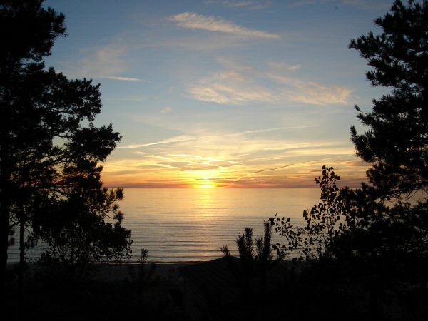
Sunset, Georgian Bay, October 2006.
"Chemtrails" - Spreading Trail Identification System:
The following is the work of long time chemtrail activist Louis Aubuchont of Parsonsfield, Maine (USA) and is based upon information originally from http://watchthesky.org/chems/chemdata.htm and also with due credit to
Scott Stevens for his inspiring help. It is particularly applicable to the United States although similar sources of data may be available in Canada and other countries. Here then - in Lou's own words:
To date I have found that by using the following formula of available information in concert with personal observations it is possible to determine contrail, or persistent contrail from 'Anomalous Spreading Trails' with nearly 100% certainty. Of course, no system is fool proof, and there are instances when this method is diminished in it's ability - bad weather, overcast that does not permit observation, etc. There is no speculation or conjecture to this system - just facts that are provided by reliable sources of data.
As laid out below the "Spreading Trail Identification System" may seem complicated but it is only four sources of data and when used together as - Observations + Aircraft Tracking + Upper Air Sounding Data + Aviation Weather Icing Data, they add up to empirical evidence which proves what many of us already know to be fact: that aerosol spraying and 'Anomalous Spreading Trails' from the spraying are a reality.
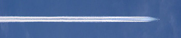
1. Observe trails and spreading trail activity in real time - make notes of: times + sky conditions + types of trails being made and numbers + identify type of aircraft involved if possible and numbers + altitude estimates and directions of flight + photograph, if possible, with digital date, time stamp for record + note any abnormal trail activity from that of a normal contrail, grid formations, parallel trails, circular or 'X' type trails, stop and go, or skipping-broken trails, falling or "drippy" trails and so on.
Normal contrails should form behind aircraft at high altitudes in various straight line lengths due to atmospheric conditions, and dissipate within 5-10 minutes of forming. Any deviation from this (as noted above) constitutes abnormal contrail / 'Anomalous Spreading Trail' behavior.
Normal persistent contrails form only rarely at high altitudes when atmospheric conditions (temperature -40° C. and 60% + humidity) are just right. It is not normal to see persistent contrails forming with regularity as the atmospheric conditions that allow them to form is sporadic and dictated by nature - not every time that an aircraft flies overhead.
2. Using FlightAware or other flight tracking program, determine whether or not the aircraft that you are observing are being tracked in near real time by the tracking program.
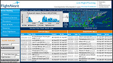  Most commercial aircraft are tracked by the FAA within the U.S. Other countries may have similar tracking programs and in turn make that tracking data available to the public via tracking programs such as 'FlightAware' and 'Flight Explorer' in near real time. If the aircraft that you have observed do not show up on these tracking programs then you must assume that they are exempt from being tracked. Only military type aircraft, and some Government aircraft are exempt from tracking. The tracking is not done by radar but by receiving transponder information "broadcast" by the aircraft in question.
Within the United States aircraft observed and reported to be involved with this aerosol spraying, and these 'Anomalous Spreading Trails,' often do not show up on these tracking programs.
That should cause many questions to be asked as it is against FAA regulations as well as military flight regulations for any large body jet aircraft to conduct operations, maneuvers, or training exercises over populated civilian areas without notification by the Secretary of Defense ninety days prior to any such operation - and only then with the express permission of the Governor(s) of the affected state(s) under a Special Use Authorization of limited time only under U.S. laws and regulations governing air space use.
Operations of any kind by military aircraft over any state must be sanctioned by said state(s) unless National Security is at issue.
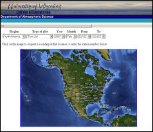
3. Check at NWS (National Weather Service) Upper Air Sounding Data and determine the temperature and humidity values at flight altitudes - keeping in mind that for normal contrails to form, linger, and spread to persistent contrails temperatures must be -40° C. or lower, and humidity values must be 60% or higher.
 If one or both of these conditions are not present then normal contrails/persistent contrails cannot form unless there is Clear Air Ice Saturation. (See item #4.)
Much about using the NWS Upper Air Sounding Data has been subject to 'debunking.' Even though it is sound, reliable science that is used in meteorology and aviation every day, the skeptics assert that this data alone is not credible. So, other sources of reliable, verifiable, empirical data are also used in conjunction with the Upper Air Sounding Data to support each other.
4. Check with NOAA Aviation Weather Icing for pilot reports and jet aircraft flight level ice data with regard to flight level icing and areas of Clear Air Ice Saturation and Ice Advisories to determine if the area of your observation(s) has possible Clear Air Ice Saturation or not.
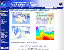 (Note: 'Pilot Reports' for specific areas of icing in icing advisory areas. Even though icing advisory areas are usually large, they may or may not produce icing conditions, and noting the 'Pilot Reports' are a must in determining the true presence of 'Clear Air Ice'.)
By using the Aviation Weather Icing Data and Pilot Reports of icing you can rule out (or not) the possibility that the spreading trails that you have observed are due to Clear Air Ice Saturation. This very same data has been used by those debunking in saying that the spreading trails are due to Clear Air Ice Saturation. This Aviation Weather Icing page above takes care of that problem
very well.
Using three sources plus your own observations to confirm the difference between normal contrails/persistent contrails and 'Anomalous Spreading Trails' is just good research based on science - not speculation, and provides scientific evidence which conclusively proves that aerosol
spraying is taking place on a large scale worldwide.
The point here is not to track every spraying aircraft that one observes but to make a firm case for a few. In doing so the probability is that many more such aircraft are out there involved in criminal activities in your sky without your informed consent.
|
You are invited to contact us at the "Holmestead".
|